← Chongqing

Chongqing · 金佛山

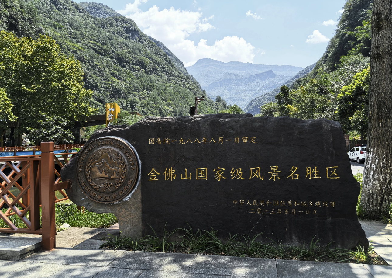
Jinfo Mountain (Jinfoshan)

🎫 Ticket 80 RMB
🕘 Opening Hours - Scenic Area: 08:00-17:30 (last entry at 16:30) - Cable Car: 08:30-17:00 - Note: Jinfo Mountain covers a vast area; it is recommended to allow a full day for the visit; if you want to see the sunrise and sea of clouds, you can choose to stay overnight on the mountain
🕘 Opening Hours Saturday/Sunday: 08:00–17:30 (last admission at 16:00)
🚇 Metro From the city center, take the metro to Chongqing East Station (transfer at Liujiaping Station on Line 6) or Chongqing North Station (Lines 3/10), then transfer to high-speed rail to Nanchuan North Station, then take the scenic area shuttle bus;
📍 Address Jinfo Mountain Scenic Area, Nanchuan District, Chongqing (entrances available on south slope/west slope/north slope) Map ↗
🎧 15 audio walking guides for Jinfo Mountain (Jinfoshan) — listen on the spot in the YOLO HAPPY app. →

Inside Jinfo Mountain (Jinfoshan)

Main Gate (North Gate) · 大门

🎧 In app
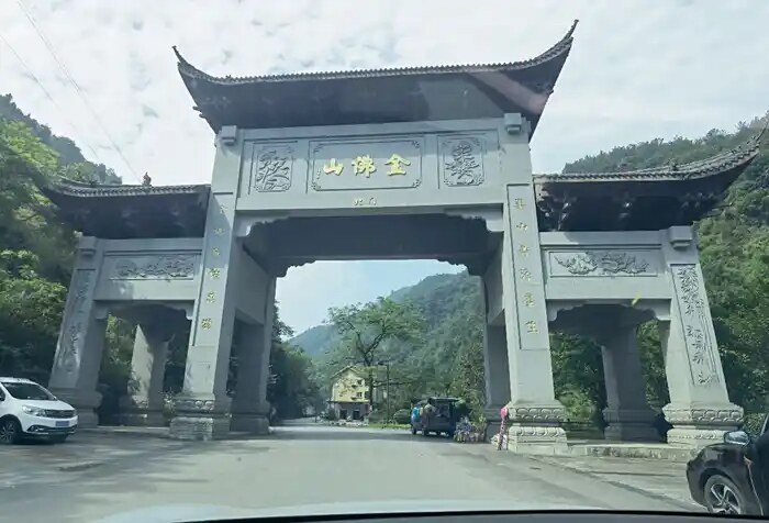
Main Gate (North Gate)

The Main Gate sits at the foot of Jinfo Mountain's north slope near Tianxing Town and serves as the first stop for most visitors. The entrance complex combines a large parking lot, visitor center, ticket windows and self-service kiosks where combined tickets for admission, cableway and shuttle can be purchased. An eco-shuttle bus ride of about 20 minutes reaches the cableway lower station, passing lower-zone sights such as Bitan Valley. The visitor center offers panoramic maps, rain-poncho rental and luggage storage, and doubles as the registration point for winter ski equipment. Outside the gate, Tianxing Town provides dining, lodging and specialty shops—a common base for two-day "valley-to-summit" itineraries.
Bitan Valley (Green Pool Secluded Gorge) · 碧潭幽谷

🎧 In app
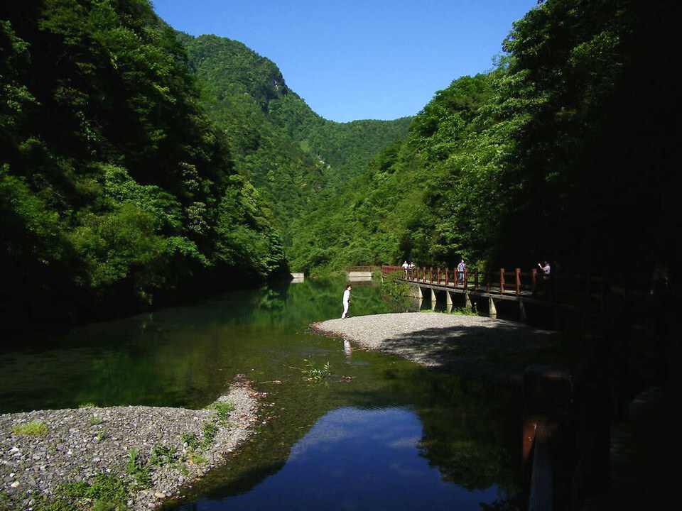
Bitan Valley (Green Pool Secluded Gorge)

Located at 700–1,000 m elevation on Jinfo Mountain's north slope, Bitan Valley is the key lower-zone landscape along the route from the main gate to the cableway lower station. The roughly 3 km gorge winds up along a mountain stream between steep, densely forested cliffs that shelter rare species such as yew and dove tree. Over a dozen deep pools dot the valley—the largest, "Bitan" (Emerald Pool), is jade-green and translucent, traditionally said to be where ancient monks washed their alms bowls. Wooden boardwalks and stone paths pass waterfalls, cascades and moss-covered walls; summer temperatures run 5–8 °C cooler than the base, making this a classic hot-season hiking route. The full walk takes about 1.5–2 hours.

Cableway Lower Station (North Slope) · 索道下站

🎧 In app
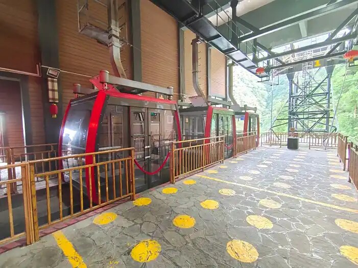
Cableway Lower Station (North Slope)

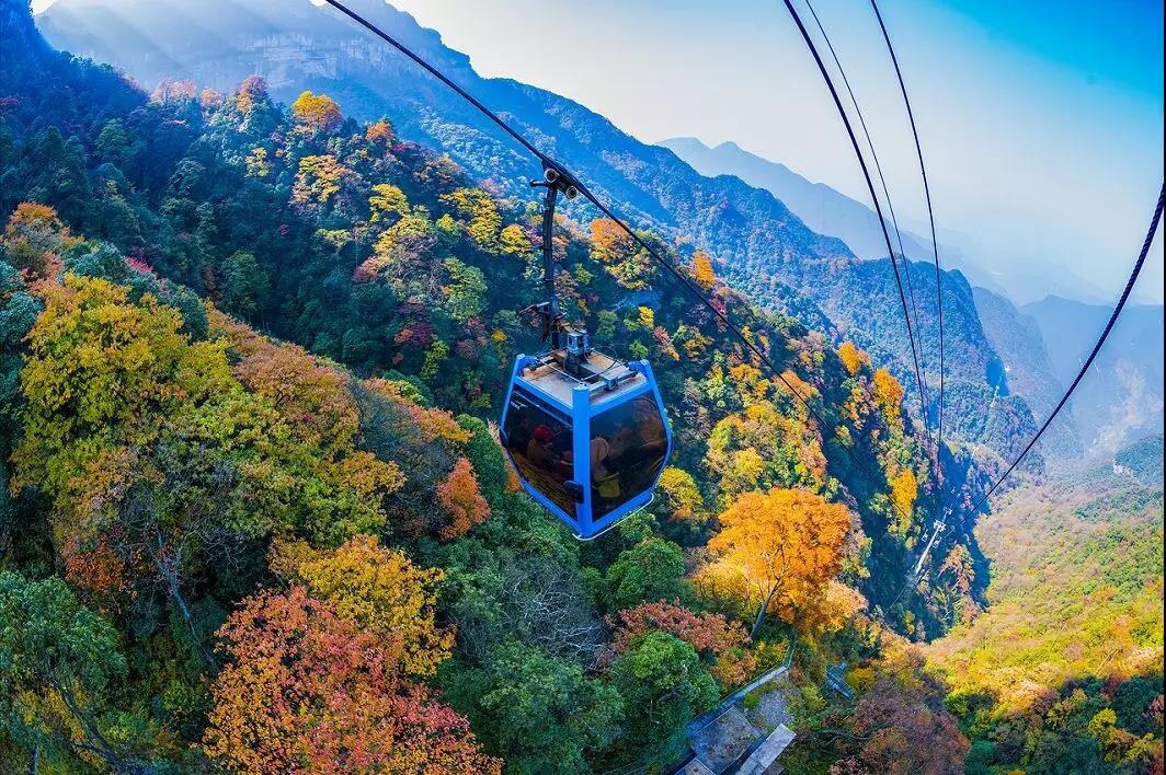
The lower station of Jinfo Mountain's north-slope cableway sits at about 1,100 m above Bitan Valley and is the mountain's most critical transit hub. The cableway spans roughly 1,100 m with an elevation gain of about 600 m; each cabin holds dozens of passengers and the ride takes about five minutes, offering aerial views of gorges and primeval forest. The lower station has a waiting hall, ticket windows and a rest area; queues at peak times can reach 30–60 minutes, so off-peak travel is advised. An outside viewing platform frames the main summit ridge and serves as a key photo spot for winter snow and autumn foliage. Exiting the upper station places you at Qianniuping Sky Street—the gateway to the summit zone. The cableway may suspend operations in high wind or thunderstorms.

Qianniuping Sky Street · 牵牛坪天街

🎧 In app
Qianniuping Sky Street

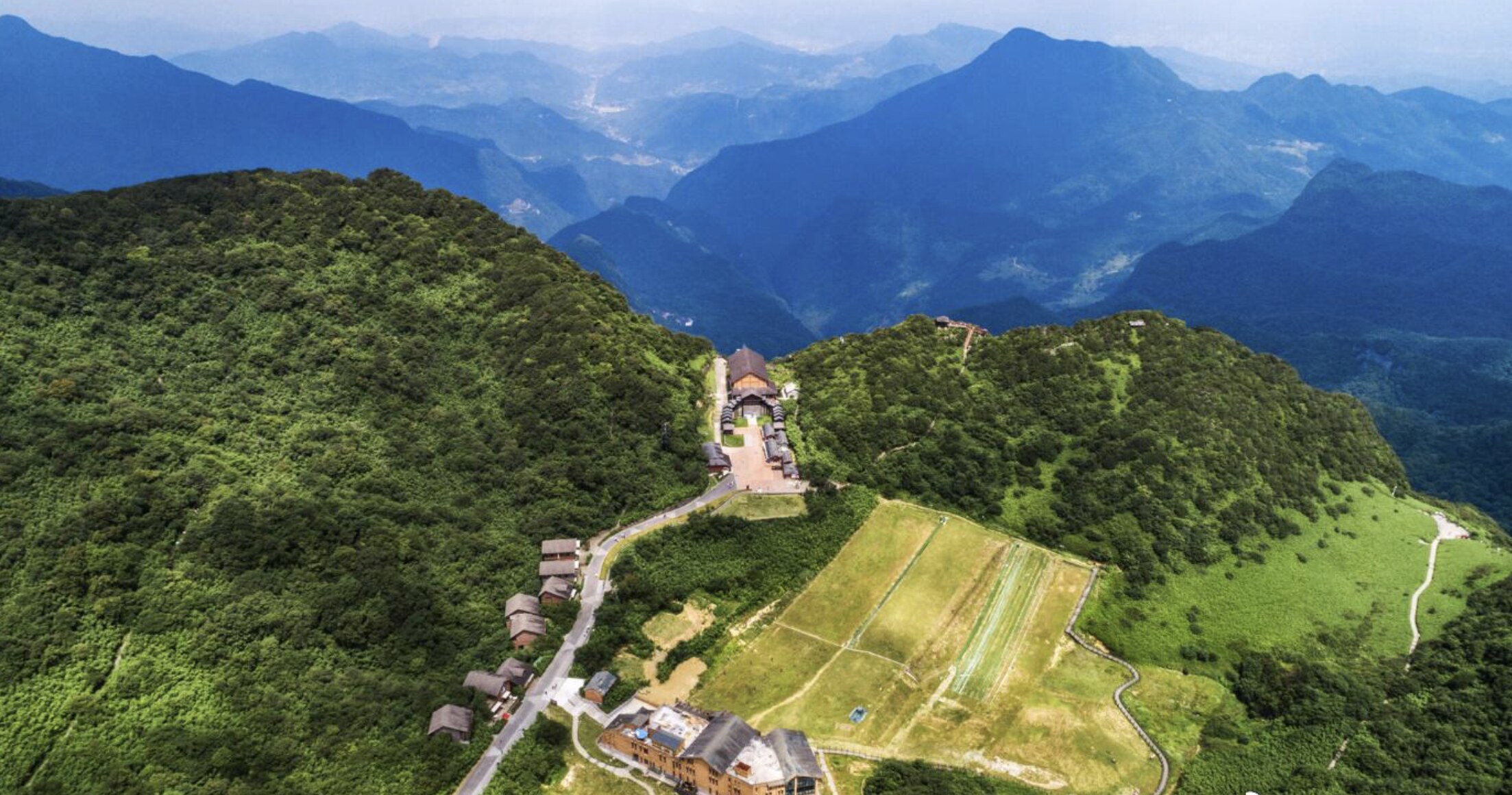
Qianniuping Sky Street lies at the exit of the north-slope cableway upper station at about 2,000 m, named after the Qianniuping meadow. It is the hub of Jinfo Mountain's summit zone, with restaurants, specialty shops, a convenience store, a café and viewing terraces offering local delicacies such as square-bamboo shoots, Jinshan cured meat and alpine potatoes. A large route map at the plaza helps visitors choose directions: east to Golden Turtle and Cloud Walkway, west to Medicine Pool Dam and Ancient Buddha Cave, north to Arrow Bamboo Forest and Azalea Prince. In winter the street becomes the ski-service center with equipment rental and access to the ski slope. Lodging here makes summit sunrise and stargazing possible.

Arrow Bamboo Forest Sea · 箭竹林海

🎧 In app
Arrow Bamboo Forest Sea

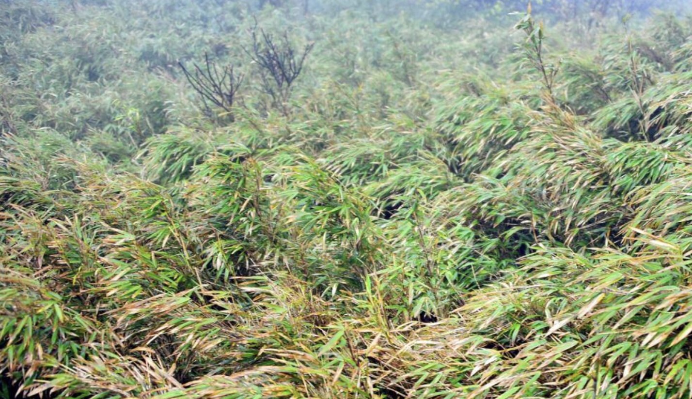
The Arrow Bamboo Forest Sea covers over 10 km² at 1,900–2,100 m on Jinfo Mountain's summit, dominated by West-China arrow bamboo (Fargesia) standing 2–4 m tall in dense, sun-dimming stands. As a core zone of the national nature reserve, it shelters rare species such as musk deer, golden pheasant and white-crowned fork-tail, and lies along the southern potential corridor of the giant panda's historical range. Wooden boardwalks thread through the groves—rustling leaves and cool breezes in summer, golden-tipped bamboo contrasting with autumn colors. Arrow bamboo flowers once every 60–120 years, after which entire stands die off and naturally regenerate, a key research subject for the mountain's ecologists. An eco-education signboard and rest pavilion mark the entrance.

Golden Turtle Facing the Sun · 金龟朝阳

🎧 In app
Golden Turtle Facing the Sun

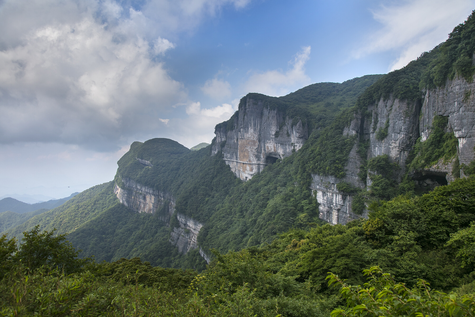
Golden Turtle Facing the Sun perches on the eastern cliff edge of Qianniuping at about 2,100 m and is one of Jinfo Mountain's most recognizable rock formations. Shaped from Cambrian limestone over hundreds of millions of years of weathering and dissolution, the roughly 10 m long, 5 m high boulder resembles—when viewed from the east—a giant stone turtle lifting its head toward the sun, its shell, head and limbs clearly defined. Facing open valleys to the east, it is the mountain's premier sunrise spot: dawn clouds churn, the sun crests the ridge, and golden light floods the turtle's back. A wooden viewing platform with safety rails and an interpretive sign stands here; connecting trails lead to the Cloud Walkway and cliff-hugging plank road, making it the key node of the summit's eastern route.

Cloud Walkway · 云端步道

🎧 In app
Cloud Walkway

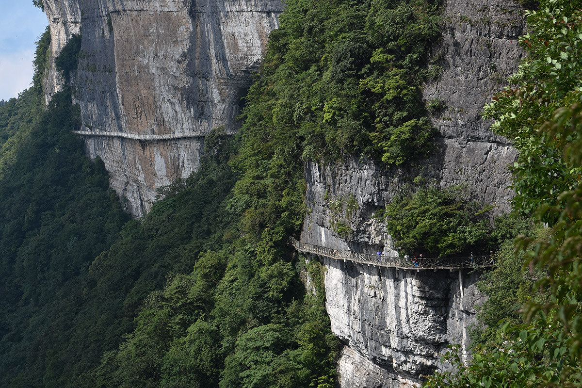
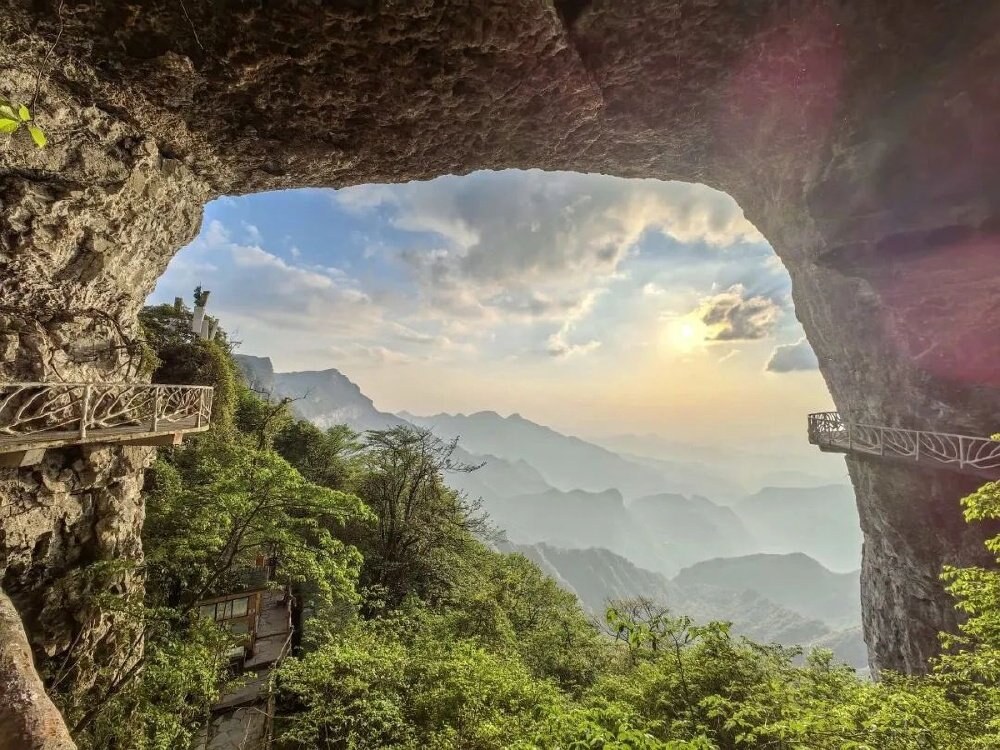
The Cloud Walkway runs along the cliff face between Qianniuping and Golden Turtle at 2,000–2,100 m, stretching about 1.5 km—the most iconic aerial route on Jinfo Mountain's eastern summit. Carved along a karst escarpment with sections of cantilevered steel, it places a rock wall on one side and a plunging valley on the other; when mist swirls in, walking it feels like treading on clouds—hence the name. Three projecting viewing platforms offer views of the Nanchuan mountain ranges and the lower-zone gorges, and are prime spots for the mountain's "Buddha's halo" and sea of clouds. The full route has safety rails and anti-slip surfacing; it may close in rain, and those with acrophobia should proceed with caution. A safety signboard and rest pavilion mark the entrance.

Swallow Cave and Lingguan Cave · 燕子洞和灵观洞

🎧 In app
Swallow Cave and Lingguan Cave

Swallow Cave and Lingguan Cave lie about 200 m apart on the west side of Qianniuping and form key parts of Jinfo Mountain's karst-cave system. Swallow Cave has a roughly 15 m wide, 8 m high entrance opening into a spacious chamber where thousands of rock swallows nest year-round; in spring and summer they dart in and out like dark arrows—hence the name. Inside, an underground stream and stalagmites, curtains and flowstone decorate the chamber. Lingguan Cave is named for a Daoist Lingguan statue once placed at its mouth; its interior features stalactites, columns and cave flowers, with some walls bearing natural "Buddha" silhouettes where monks and Daoist priests once practiced. Both caves are lit and equipped with boardwalks; the interior temperature holds at 12–15 °C, so an extra layer is advisable in summer. Visiting both takes about 40–60 minutes.

Azalea Prince · 杜鹃王子

🎧 In app
Azalea Prince

,2050,(Rhododendron rex),12,40,8,,。,、、40,10。45,,10,,、,。,。

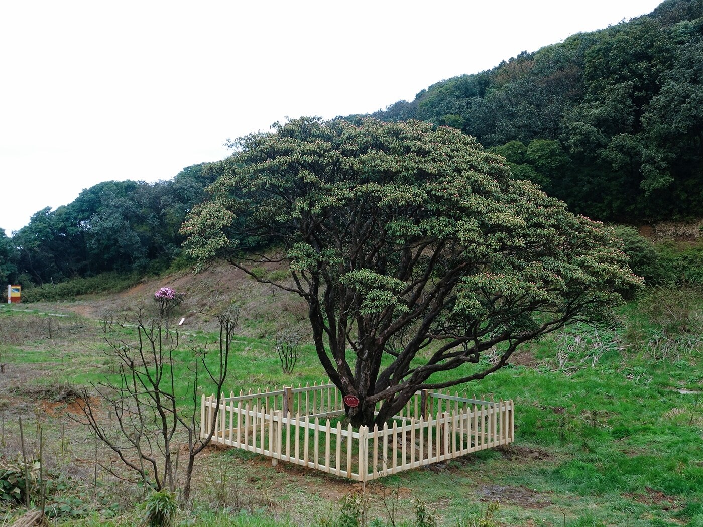
The "Azalea Prince" stands at the edge of the Arrow Bamboo Forest at about 2,050 m—an estimated 1,000-year-old wild Rhododendron rex, roughly 12 m tall, 40 cm in trunk diameter and nearly 8 m across the crown, making it the largest ancient wild rhododendron discovered on Jinfo Mountain. The mountain is a diversity center for Chinese rhododendrons, hosting over 40 species including more than 10 endemics. Each April–May the Prince bursts into bloom, its 10 cm-wide flowers ranging from pink to deep crimson, layered against a backdrop of bamboo, moss and multicolored forests—the most photographed spot of Jinfo Mountain's spring season and a key site for botanical education. A boardwalk, viewing platform and interpretive sign stand beside the tree.

Yaochiba (Medicine Pool Dam) · 药池坝

🎧 In app
Yaochiba (Medicine Pool Dam)

Yaochiba sits southwest of Qianniuping at about 2,000 m—a roughly 30,000 m² alpine meadow and wetland complex. The flat, grassy expanse is dotted with dozens of natural mineral springs and pools; Jinfo Mountain monks once drew water here to brew herbal remedies, giving the place its name ("Medicine Pool"). Surrounded by arrow bamboo and rhododendron shrub, with the Jinfo summit ridge and karst pinnacles on the horizon, the meadow turns golden in autumn against layered forests—one of the mountain's signature fall scenes. Boardwalks, rest pavilions and viewing platforms are provided, and the dam is a popular camping and stargazing spot. Westward trails lead to Ancient Buddha Cave and Jinfo Temple; southward to the Ecological Stone Forest.

Gufo Cave (Ancient Buddha Cave) · 古佛洞

🎧 In app
Gufo Cave (Ancient Buddha Cave)

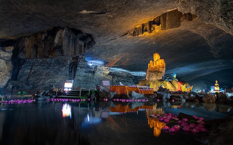
Gufo Cave lies west of Yaochiba at about 2,000 m and is the largest explored karst cave on Jinfo Mountain, with a total passage length of about 3 km and a developed tour route of roughly 1.2 km. Natural stone Buddha carvings at the entrance—believed to have been chiseled by monks in the Ming–Qing era from existing rock formations—gave the cave its name ("Ancient Buddha"). The interior is vast: the largest chamber rises about 30 m high and exceeds 5,000 m² in area, filled with stalagmites, stalactites, columns, curtains and cave flowers. The "Sea-Calming Pillar," a 15 m-tall, 1 m-diameter column, is the cave's signature feature. Warm-yellow lighting enhances the Buddhist atmosphere, with several stone Buddha figures and sutra inscriptions along the route. The cave holds at 11–14 °C year-round with high humidity—wear non-slip footwear. The full walk takes 50–70 minutes.

Jinfo Summit (Jinfo Peak) · 金佛顶

🎧 In app
Jinfo Summit (Jinfo Peak)

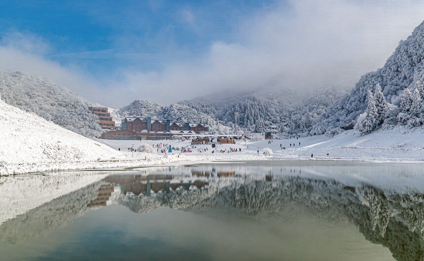
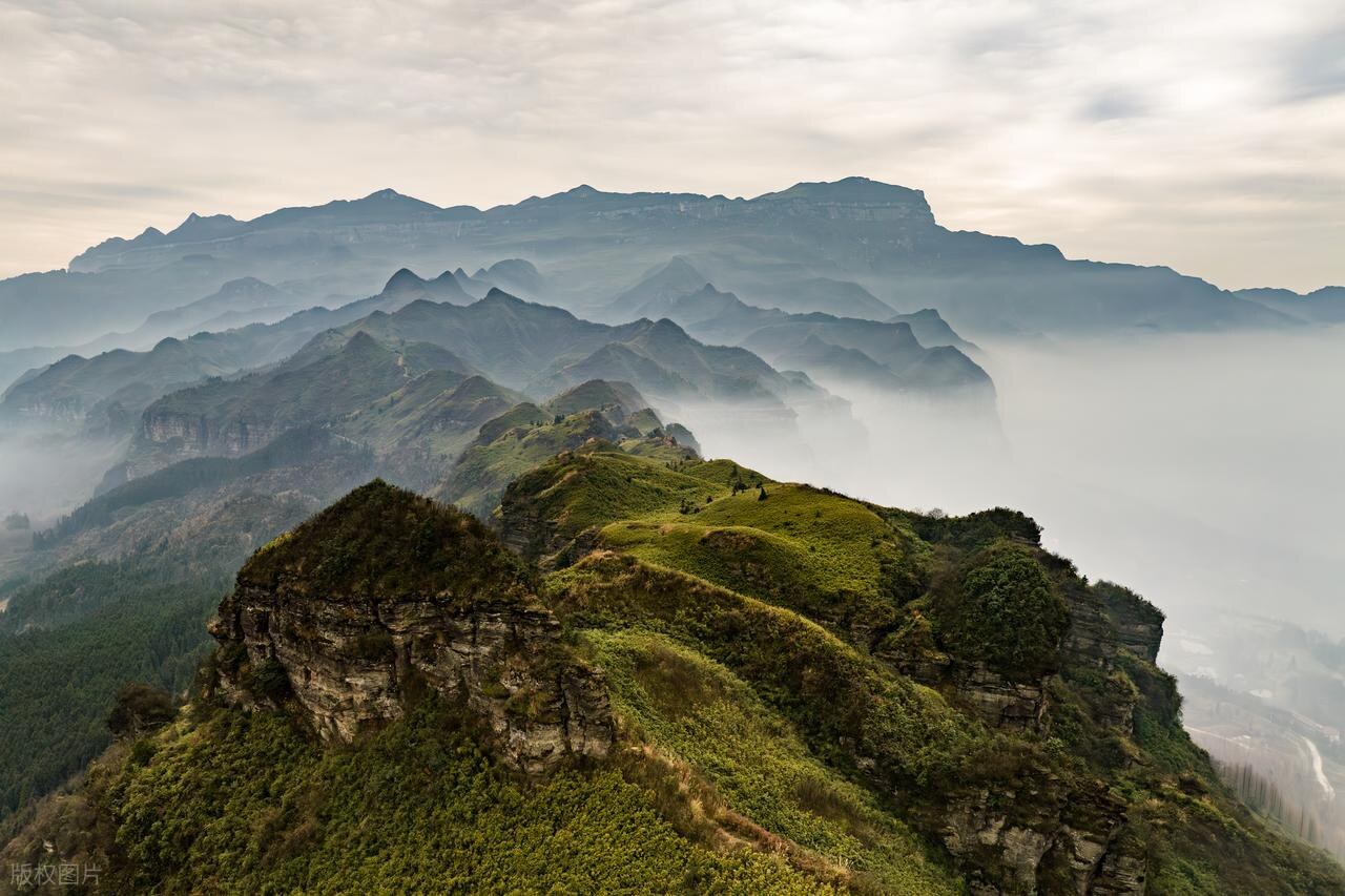
At about 2,238 m, Jinfo Summit is the highest point and spiritual symbol of Jinfo Mountain. The mountain takes its name from the main ridge's resemblance to a reclining Buddha when seen from a distance, and the summit occupies the "head" position. From the top, visitors can survey 360° of the Dalou range; on clear days the Guizhou Dalou main ridge and Nanchuan city are visible. Nearby stands Jinfo Temple (Fengzui Temple), the mountain's Buddhist heart—originally founded in the Song dynasty with later reconstructions, housing statues of Shakyamuni and Guanyin. The summit viewing platform with safety rails is the premier spot for sunrise, sea of clouds, "Buddha's halo" and stargazing. In winter, snow can accumulate to tens of centimeters, creating a rare southern snow-field scene. The walk from Qianniuping Sky Street takes 40–50 minutes, partly on stone steps.

Ecological Stone Forest · 生态石林

🎧 In app
Ecological Stone Forest

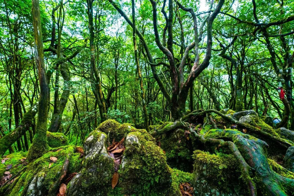
Covering about 2 km² south of Yaochiba at roughly 2,000 m, the Ecological Stone Forest is a key element of Jinfo Mountain's karst landscape. Unlike the bare stone teeth of Yunnan's Shilin, Jinfo's pinnacles and stone buds are cloaked in moss, ferns, shrubs and trees—stone and forest merged into one, earning the name "living stone forest." The pinnacles, 3–8 m tall, take myriad forms—swords pointing skyward, beasts crouching among trees—interspersed with arrow bamboo, rhododendron and rare square bamboo, creating a unique "forest-on-stone" micro-ecosystem. In 2014 Jinfo Mountain was inscribed as part of the "South China Karst" Phase II World Natural Heritage, with the Ecological Stone Forest as a core heritage element. Boardwalks and interpretive signs guide visitors through a 30–40 minute walk—the best outdoor classroom for the mountain's karst geology and biodiversity.

West Gate Cableway Lower Station · 西门索道下站

🎧 In app
West Gate Cableway Lower Station

The West Gate Cableway Lower Station sits at the foot of Jinfo Mountain's west slope at about 700 m—the starting point of the western passenger cableway. At roughly 2.4 km long with a 1.3 km elevation gain, the 15-minute ride is the longer and more scenically varied of Jinfo Mountain's two cableways. Cabins climb along a ridge, offering aerial views of primeval forest, stream-fed waterfalls and distant cloud seas; autumn foliage and winter rime-and-ice scenes are spectacular. The lower station has a waiting hall, ticket windows and a parking lot, plus an adjoining west-slope visitor center and dining facilities. The western route generally has fewer visitors and shorter queues than the north slope, ideal for self-drivers arriving via the western G65 expressway. An outside platform frames the western face of the main summit ridge.

West Gate Visitor Center · 西门游客中心

🎧 In app
West Gate Visitor Center

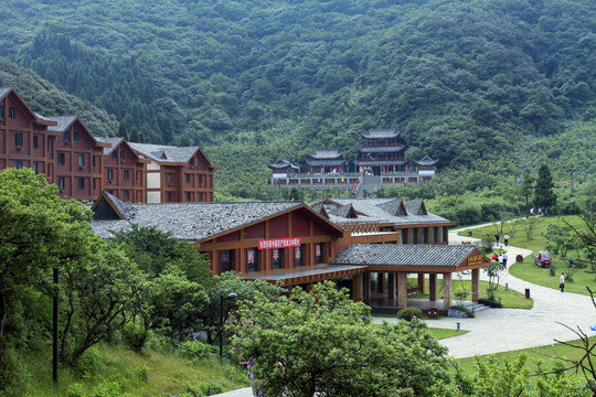
The West Gate Visitor Center stands at the foot of the west slope beside the West Gate Cableway Lower Station, serving as the main entrance and service hub for the western route. The building blends modern functionality with mountain vernacular style, housing a large ticketing hall, self-service kiosks, an information desk, luggage storage, rain-poncho rental and a first-aid point, where visitors can purchase admission, cableway and shuttle combo tickets. Outside are a large parking lot, restrooms, dining outlets and specialty shops selling square-bamboo shoots, Nanchuan rice and dried local produce. Inside, a geology-and-biodiversity exhibit uses panels and specimens to introduce Jinfo Mountain's World Natural Heritage karst geology, rare flora and fauna and rhododendron resources—an ideal "knowledge stop" before heading uphill. The walk from the center to the cableway lower station is about 3 minutes.

Get the app

The tool solved one problem. The app handles the whole trip.

Per-trip visa judgements, audio guides, prep checklists, and a real human concierge — offline-ready, in your language.

Download for iPhoneFree to download · No OTA upsells